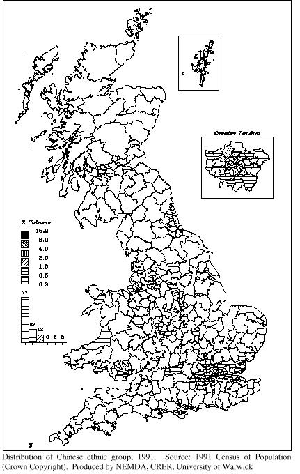
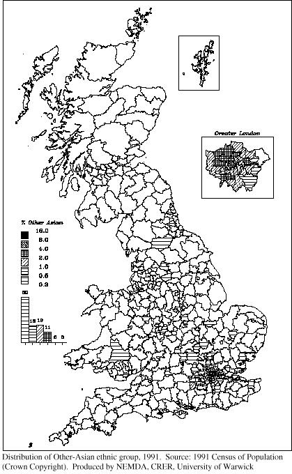
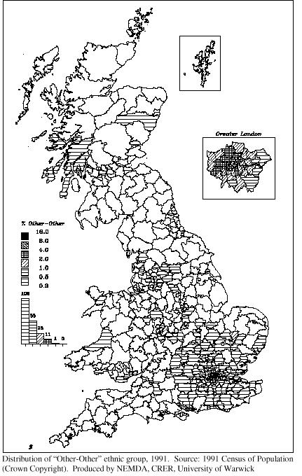
Maps of the geographical distribution of Chinese and "Other" ethnic groups in Great Britain, 1991
These maps are based on data from the 1991 Census of Population, and the ethnic categories are those used by that Census. The geographical areas depicted are the 459 local authority districts which were defined following the 1974 local government re-organisation.
|
|
|
|
|
|
|
|
These maps are in JPEG format. You can view them at a larger size (in Netscape) by moving the mouse pointer over the map, clicking the right hand mose button and choosing the option "view image". To get an Adobe Acrobat (PDF) version of a map, click on the highlighted link above the map.
N.B. To go to the Adobe web-site, from where you can download the latest version of the Acrobat PDF reader,click on the icon below.
![]()